Blog Catalog

Showing posts with label weather. Show all posts

Tuesday, February 16, 2021

Great News, Campers!


Yes, great news! Yesterday and last night were the lowest, worst temperatures we'll see! 


From here forward, nearly completely in a straight line, it nothing but warms up from now on! Yahoo!! 

The worst of Winter is over!!!

Yes!!!

Enjoy!!  And today we have sunshine, too!


Saturday, June 1, 2019

What's It Going to Take to Get Us to Recognize Manmade Climate Change?


I wonder if very many of us in the nation and world are paying attention to all the weather-related events, disasters and catastrophes included, that have been taking place this year. Herewith are just a few of the latest.

This took place the week before the Memorial Day weekend.

Multiple highways across Missouri shut down due to flooding


Check out how many roads were closed across the entire state of Missouri.


This was just last weekend:

Memorial Day weather: Heat wave scorches southern US


Then this happened.

Vehicles stuck in foot-deep hail in Omaha, Council Bluffs area


This one was four days ago.


Then we all know this took place this last week locally.


This is going on now, to the South of us, of course, and is still going on.

These next two are current also.


This is the past month.


This is just how large an issue this is.


You can go here and see just some of the damage.


As if all that isn't enough, this story broke two days ago.


"Abnormally high temperatures have led to unsafe travel conditions, uncertain ecological futures and even multiple deaths"

So how long, America? How long until we first accept global warming is happening and it's taking place because we humans are pumping so much CO2, carbon dioxide, into the atmosphere? And then, second, how long until we do something about it?


Wednesday, February 13, 2019

How Much Do We Have to Lose Across the Planet Until We Accept Climate Change?


Did you see this?

Did you see how many head of cattle, alone, were lost recently in Australia, with their flooding?

Stranded cows are seen surrounded by floodwater in Queensland, Australia, on Feb. 5, 2019.


500,000 head of cattle--or more, if you read the article--died last week in the flooding in Australia.

And this doesn't include all the other animal life that died in their scorching heat waves in the last month. I posted on this earlier.


Australia's Heat Wave Has Been Devastating For Animals


And that's just Australia, of late. Check out what it's done in California last year.


Then there is around the world.


At what point do the climate change deniers actually look, recognize the losses and damage and agree with us we need to do things to change?

What more does it have to take?


Saturday, November 3, 2018

Coldest Town in Missouri? Kansas?


Another "clickbait" article out on the interwebs this week. This one is kind of fun.

Image result for coldest town in every state


In Alaska it’s Deadhorse.

Do you suppose it froze to death? 

Delaware? Bear. 

A polar bear. Of sorts.

Hawai’i, appropriately enough, it’s Kula. 

Minnesota? Embarrass. 

Embarrassingly cold?

New Hampshire is Colebrook. Also mis-named. Should be Coldbrook. Right? 

In Utah, it’s Coalville. 

Seems like that should be the warmest place in the state. At least indoors.

Kansas? No surprise. At all. At least no surprise to any of us who've paid attention to the region weather forecasts. 

Goodland. 

Talk about poorly named. Wow.

But Missouri? 

Bunker.

Wth is Bunker?


Friday, March 31, 2017

Kansas City: "NO BLUE SKIES FOR YOU!"


Gray.

Gray as far as you can see.

Gray above. Gray yesterday, gray tomorrow, gray the day after that and the next week.


Sure, we've needed the rain and it's welcome, certainly. We all recognize that. And we have to have it.

But occasionally, can't we have some direct sunlight?

Some blue skies?

Please?


Wednesday, March 22, 2017

Those 60s and 70s We Had In February?


This article came out today based on a report just released:

lastpolarbear.jpg


A little from it, some highlights:

More than 11,700 daily temperature records across the U.S. were broken in February, with the average temperature 7.3 degrees warmer than normal for the last full month of winter. According to the World Meteorological Organization (WMO), the Arctic “witnessed the polar equivalent of a heatwave.” This spurred dangerous sea ice melting.

“Even without a strong El Nino in 2017, we are seeing other remarkable changes across the planet that are challenging the limits of our understanding of the climate system. We are now in truly uncharted territory,” World Climate Research Program Director David Carlson said.

Out of the 17 hottest years ever recorded, 16 occurred since 2000.

Prof Sir Robert Watson, a distinguished climate scientist at the UK’s University of East Anglia and a former head of the UN’s climate science panel.

“Our children and grandchildren will look back on the climate deniers and ask how they could have sacrificed the planet for the sake of cheap fossil fuel energy, when the cost of inaction exceeds the cost of a transition to a low-carbon economy,” Watson said.

“Arctic ice conditions have been tracking at record low conditions since October, persisting for six consecutive months, something not seen before in the [four-decade] satellite data record,” said Prof Julienne Stroeve, at University College London in the UK. “Over in the southern hemisphere, the sea ice also broke new record lows in the seasonal maximum and minimum extents, leading to the least amount of global sea ice ever recorded.”


Food for thought, for sure.

At what point do we humans do something, do more, about this?

Here's hoping we don't have Summers of 100 degrees and more and for long stretches of time.

Additional links:

What-is-global-warming-img.jpg

Monday, October 6, 2014

Good moon rising


The exact time of the next full moon is:
Wednesday * 8th October 2014 * 12:50:36 pm
Central European Summer Time (CEST)
Moon sign: Aries 15° 05'

Saturday, February 22, 2014

Where we are right now, weatherwise


Florida has been in the 80's and very humid.

Southwest Missouri is far under the average for rainfall this year, to date.

New Mexico is extremely dry, still in drought conditions.

California has been in the low to mid- 80 degree weather range.    Most all Winter.

Meanwhile, Australia is burning and drying up, in severe, prolonged drought conditions.


You tell me.


Tuesday, November 19, 2013

Let's put a few very recent weather events in perspective


Naturally, we are all likely extremely aware of what has been reported to be the largest typhoon ever, hitting the Philippines so recently:


And the estimates of those killed in this historic weather disaster are still being tallied, it's so bad.

And we're certainly aware of this weekend's tornados all over the Eastern one-third of the country, sure.  But did you know this?

Photo: Hardest hit was Washington, a town of 15,000 people east of Peoria hit by an EF-4 tornado packing winds of 170 to 190 mph. Whole blocks were leveled. http://trib.in/1bLhvdv

Not to be done there, are you aware of this natural disaster, just now unfolding?


So there you are.  Three really large weather events--catastrophes, really--all within what? 2 weeks?

At what point do we start doing something about all this?

At what point do we all accept that the way we all live, collectively, isn't sustainable?

And that it's likely killing fairly large numbers of us?


Monday, June 17, 2013

One billion dollar weather disasters in the US


Listening to the Weather Channel last evening, with a lot of thunderstorm warnings all around my new 'burg--yet again--the announcers mentioned that the last several years has seen a great deal of $1 billion dollar weather disasters in the US. They seemed to softly suggest that it was likely due to global warming and/or climate change.

So I Googled:

Billion Dollar U.S. Weather Disasters, 1980–2013

Source: National Climatic Data Center
 
The U.S. has sustained 123 weather-related disasters during the 1980-2012 period in which overall damages and costs reached or exceeded $1 billion at the time of the event. Twelve occurred during 2011 alone—the most for any year on record, with total costs being approximately $52 billion.

Then I searched some more:


According to NCDC’s 2012 weather and climate disasters information, 2012 saw 11 weather and climate disaster events each with losses exceeding $1 billion in damages. This makes 2012 the second costliest year since 1980, with a total of more than $110 billion in damages throughout the year. The 2012 total damages rank only behind 2005, which incurred $160 billion in damages due in part to four devastating land-falling hurricanes.

The 2012 billion-dollar events included seven severe weather and tornado events, two tropical cyclone events, and the yearlong drought and its associated wildfires. These 11 events killed over 300 people and had devastating economic effects on the areas impacted. With 11 events, 2012 also ranks second highest in total number of billion-dollar events behind 2011, which had 14 events.

The two major drivers of the damage costs in 2012 were Sandy at approximately $65 billion and the yearlong drought at approximately $30 billion. Sandy’s large size, with tropical storm force winds extending nearly 500 miles from the center, led to record storm surge, large-scale flooding, wind damage, and mass power outages along much of the East Coast.

So it begs the question: at what point do we learn?

At what point do our nation's leaders stand up, recognize the situation we're in and lead the people, lead the country to what we need?  That is, how soon until they guide us onto a path of far more sustainable lives and living?

We need to get started.

Links: Billion Dollar U.S. Weather Disasters, 1980–2013 | Infoplease.com http://www.infoplease.com/ipa/A0882823.html#ixzz2WWF0Lozm

Billion-Dollar Weather/Climate Disasters

Saturday, June 1, 2013

At what point do we learn? At what point do we change?


I was speaking last evening, late, with a friend that recently retired from the federal government's National Weather Service and told him what I thought--that all it's going to take, I expect, is one more hit, one hit in Florida of some major city, heaven forbid, and finally, finally more people will think there likely is a good chance of humans effecting weather with all the CO2 we're putting into the atmosphere.

Heaven forbid it's Miami but there it sits, like a bit of a big bullseye, jutting out into big bodies of water. 


Purely coincidentally, after I wrote this entire piece, I ran across this article:


Because of its size and geographical position, with 1,200 miles of coastline on a peninsula sticking out into the warm waters where the Caribbean meets the Atlantic, Florida is a uniquely risky insurance market. Most of its insured residential and commercial property - 79 per cent - lies in coastal areas vulnerable to both wind damage and flooding.

Coastal property is valued at just under $3 trillion, according to a report due to be released next week by AIR Worldwide, a global leader in catastrophe risk modeling. Florida accounts for almost 30 percent of the nation's entire $10 trillion coastal exposure, AIR found.

Only New York has as much exposure, with $3 trillion in coastal property, and that compares to $239 billion in South Carolina and $107 billion in Georgia.

Miami, Fort Lauderdale, Daytona, you name it. When/if that should happen, it'll be game over for Florida, if it's a big enough storm. There will be lots more believers.

In the meantime, there's Oklahoma and Oklahoma City, repeatedly hit by tornadoes in the last week.


Did you know there were 9--nine tornadoes in the last 36 hours?

And in the last 24 hours, there was this:


And that, of course, is on top of the direct hit the suburb of Oklahoma City took in Moore, the previous week.

At what point do we think maybe the way we humans live on this planet maybe isn't sustainable?

At what point do we maybe think we need to stop pumping carbon dioxide into the atmosphere?

Thursday, May 2, 2013

On our weather forecast: uh-oh


From a Facebook post just now:

 
2"-3" of snow has fallen near Omaha this evening, and thundersnow is being reported in Nebraska City, just across the river from the northwest tip of MO. Trends are suggesting accumulating snow may make it further south and east than previously thought, and may make it into Kansas City. We'll have an updated snow forecast in a few hours.

Sunday, February 24, 2013

We may get lucky again, Kansas City


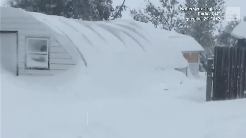
Face it, Kansas City, sure, we had a big snow the other day and we're about to get another.
 
So it goes.
 
But the fact is, we were fairly lucky on that last one, I think. Really, think about it. It hit at just about the right time for most all of us to just shut down. Companies, for the most part, wisely closed and nearly all of us stayed home.
 
With this next storm, if it stays on the track it is now, time-wise, it looks as this storm is going to do the same thing. That is, it looks as though the worst of it is to hit us after rush hour Monday evening, and hit us hardest by dawn.
 
With this in mind, we should be able to quietly, calmly (with the exception of the runs on the grocery stores today), coolly and intelligently close our offices and stores again, stay home and wait until Wednesday morning, wherein we'll all start back at it.
 
We shall see, as always.
 
Here's hoping that's what happens.
 

The latest weather/snow forecast


Another Major Winter Storm... Starting Soon - Snowfall Forecast

*This forecast is subject to change. For the latest information, check back frequently for updates*

SHARE THIS WITH YOUR FRIENDS AND FAMILY!

After looking at some fresh information, here is a look at our latest forecast regarding our next winter storm!

Our storm system will continue to dive southeastward from the Rockies today and will make its way eastward into the Texas Panhandle by the afternoon and evening. We are expecting snow to develop this afternoon across Western Kansas, although heavy snow is not expected. Some light freezing drizzle could accompany the snow with dry air aloft. The low will continue to push eastward tonight along the Oklahoma/Texas border with snow moving eastward across Western and Central Kansas. The low will undergo intensification as it moves into Central Oklahoma, which will lead to heavier snow development east of a line from Hays to near Liberal overnight tonight. The low will continue eastward with the heavier snow continuing eastward across Central and Eastern Kansas with lighter snow in Western Kansas on Monday. It is now becoming clear that heavy banding of snow could occur from South Central into portions of East Central and Northeast Kansas. The low will begin to push northeastward as it hits the Arklatex Region Monday night with snow ending by early Tuesday. 

There is a chance that Southeast Kansas will see rain for most of this event before the heavy snow moves over the area Sunday night, which is why only 1-3 inches is shown in extreme Southeast Kansas. Heavy snow will come in to play for Southeast Kansas Monday night with 3-6 inches possible across much of Southeast Kansas.

As mentioned, the heavier snow is expected to fall east of a line from around Plainville to Liberal and into Central and Eastern Kansas where 6-12 inches is possible. Banding of heavier snow is expected to occur over South Central, East Central and Northeast Kansas where a foot or more of snow is currently expected.

3-6 inches is expected across portions of Southwest and North Central Kansas with lighter amounts of 1-3 inches over far Western Kansas as upper level dynamics do not look to support heavy snow at this time.

Gusty winds and blizzard conditions can be expected with this storm over Southern Kansas. Blowing and drifting of snow can be expected with the strongest winds occurring Monday and early Monday night. This will lead to low visibilities and possibly white out conditions which will make travel extremely difficult if not impossible.

Stay tuned!

-Peyton | Winter Weather Specialist
-Brooks | Winter Weather Director
 
Another Major Winter Storm... Starting Soon - Snowfall Forecast

*This forecast is subject to change. For the latest information, check back frequently for upda...tes*

SHARE THIS WITH YOUR FRIENDS AND FAMILY!

After looking at some fresh information, here is a look at our latest forecast regarding our next winter storm!

Our storm system will continue to dive southeastward from the Rockies today and will make its way eastward into the Texas Panhandle by the afternoon and evening. We are expecting snow to develop this afternoon across Western Kansas, although heavy snow is not expected. Some light freezing drizzle could accompany the snow with dry air aloft. The low will continue to push eastward tonight along the Oklahoma/Texas border with snow moving eastward across Western and Central Kansas. The low will undergo intensification as it moves into Central Oklahoma, which will lead to heavier snow development east of a line from Hays to near Liberal overnight tonight. The low will continue eastward with the heavier snow continuing eastward across Central and Eastern Kansas with lighter snow in Western Kansas on Monday. It is now becoming clear that heavy banding of snow could occur from South Central into portions of East Central and Northeast Kansas. The low will begin to push northeastward as it hits the Arklatex Region Monday night with snow ending by early Tuesday.

There is a chance that Southeast Kansas will see rain for most of this event before the heavy snow moves over the area Sunday night, which is why only 1-3 inches is shown in extreme Southeast Kansas. Heavy snow will come in to play for Southeast Kansas Monday night with 3-6 inches possible across much of Southeast Kansas.

As mentioned, the heavier snow is expected to fall east of a line from around Plainville to Liberal and into Central and Eastern Kansas where 6-12 inches is possible. Banding of heavier snow is expected to occur over South Central, East Central and Northeast Kansas where a foot or more of snow is currently expected.

3-6 inches is expected across portions of Southwest and North Central Kansas with lighter amounts of 1-3 inches over far Western Kansas as upper level dynamics do not look to support heavy snow at this time.

Gusty winds and blizzard conditions can be expected with this storm over Southern Kansas. Blowing and drifting of snow can be expected with the strongest winds occurring Monday and early Monday night. This will lead to low visibilities and possibly white out conditions which will make travel extremely difficult if not impossible.

Stay tuned...